Friday 26 April 2013

Kyrgyzstan

Kyrgyzstan has changed since I first visited in the early 1990's, but remains a magical place. Back then it really was stepping into an alternate reality. Communism had gone away and suddenly a forbidden world was accessible after so many years of isolation.

I was one of the first westerners in the south of the country, establishing and managing the first programme for Save the Children Fund in Central Asia. Within the English department of the University I found interpreters and researchers. The geologists based in Osh, who knew the mountains, provided the field workers. Rarely have I seen such a team - they were immense in every way, and the driving force behind them all - Alfia, remains a close family friend. The one word she would never accept was 'nyet'.

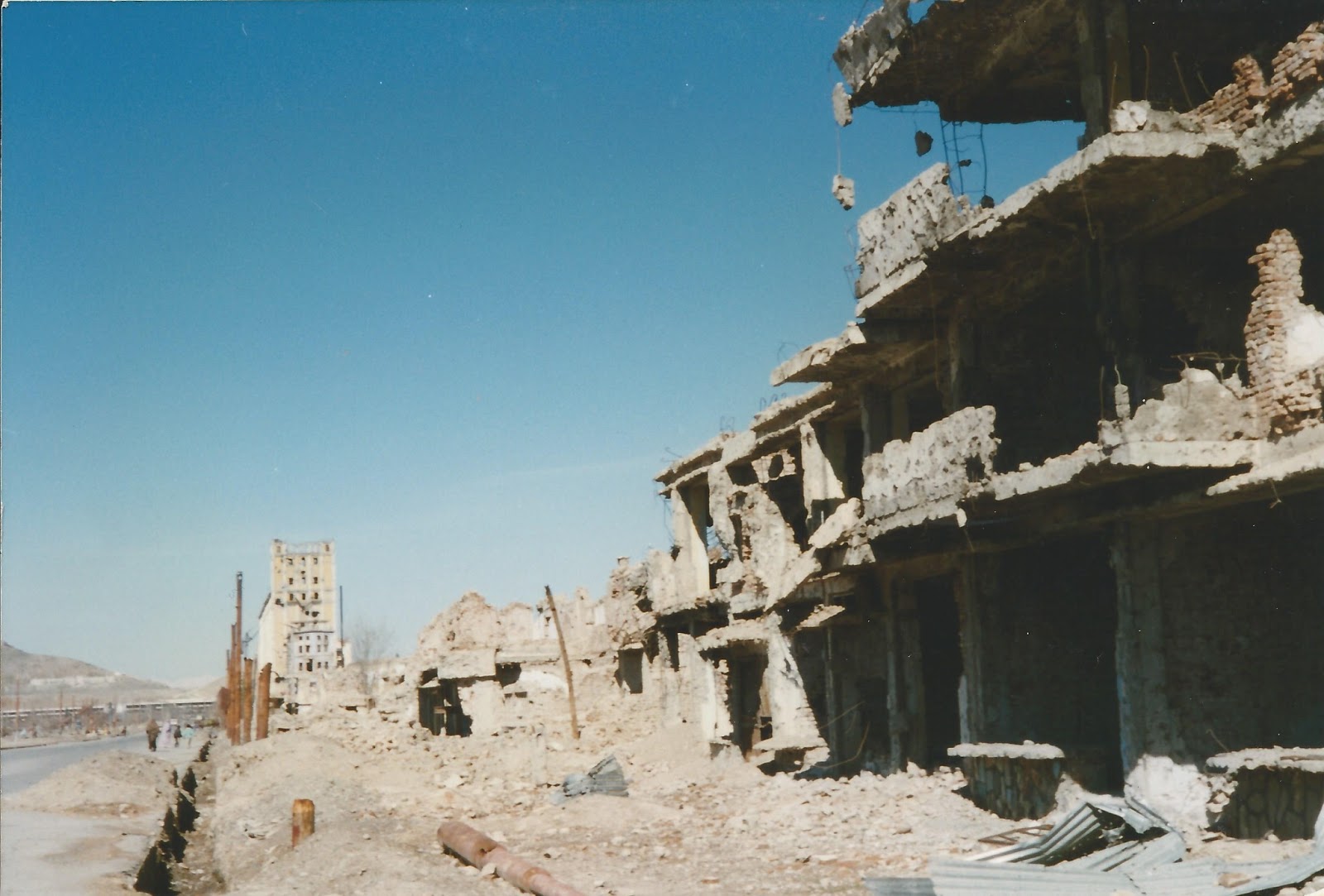
The government buildings I visited were long corridors of empty offices in pristine condition. Phones rang on identical polished desks in identical rooms but no one was there to answer, they had all left. It really was surreal.

The mid winter weather was the hardest challenge after Africa. The cold was unrelenting and just daily washing when you had to break the ice on the water indoors, was a challenge. You could see why they all drank vodka; beer froze solid in its bottle before you could swallow it.


Kyrgyz horseman in the Tien Shan

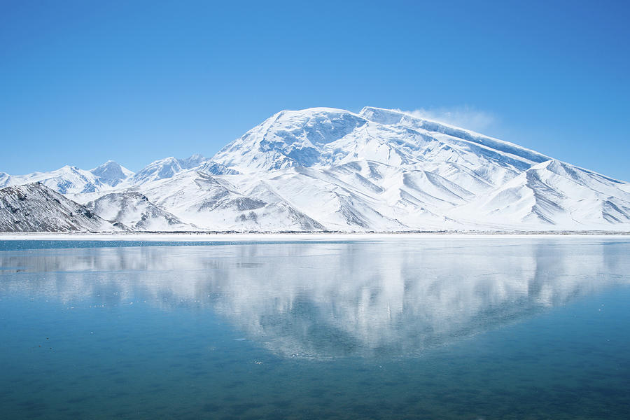
None of that mattered once you got to the Tien Shan mountains and Lake Issyk Kul, the sheer scale of the place is majestic. Endless peaks and Krygyz men hunting on horseback with full sized eagles on their arms. The hospitality of villagers who rarely see an outsider let alone a foreigner is overwhelming.

An eagle ready for hunting

It is a place where I have made many friends and to which I return as often as I can.

There is often talk of marketing the country as the Switzerland of Central Asia, but this is to do an injustice to Kyrgyzstan. This land is on a far grander scale.


The national hat of Kyrgyzstan -the 'Al Kapak' for sale in Osh market.


Sunday 21 April 2013

Lake Victoria of the Pamirs – Travels in Tajikistan.

Tajikistan is the Country with nature  on the grandest scale.

Access is via the  Pamir Highway, the second highest international road in the world, Dushambe to Khorog - 13 hours of stunning scenery, bumpy roads and scary edge of cliff track sections.

I first worked in Tajikistan in 1994 during a particularly vicious civil war which lasted up to 1997. Dushambe was full of Russian military and a place to be firmly indoors before dark.  The Garm Valley was one of the centres of opposition to the Government as was the remote eastern Oblast of Gorno Badakhshan.  

The people  unlike Turkic populations of the surrounding countries have a different culture, historically looking towards Persia (present day Iran), 

The Fann Mountains and Lake Iskanderkul are stunning but eastern Gorno Badakhshan and Khorog are the places to draw one back again and again.  Khorog was built to firmly establish the area within the Russian sphere of influence in an area contested with the British and the Emir of Bukhara.

Here the Fedchenko Glacier is the longest outside of the polar regions, Pik Lenina one of the highest and  Lake Victoria of the Pamirs, named by British cartographers in honour of their Queen. The Black Lake now goes by the name of Lake Karakul.  It's nearly 13,000 feet above sea level, 52 km in diameter and set in what is believed to be a meteorite impact crater.


Related image
Lake Victoria of the Pamirs

If the Yeti exists anywhere it is up here in the Pamirs. Stories of its existence  have been circulating since the 19th century and expeditions have been sent. One can readily believe in the possibility when alone in the High Pamirs.


Tuesday 16 April 2013

Grapes on the Shamoli Plain - Afghanistan

I crossed Afghanistan's Shamoli Plain in 1997 to ascertain the viability of an agricultural rehabilitation programme. The area had once been famous for its vineyards and exports of grapes and raisins to neighbouring countries.

As one of the most fertile areas of Afghanistan in close proximity to Kabul, the Plain was cursed with anti-personnel mines from an earlier conflict. It was considered one of the most heavily mined area in Afghanistan.


Vineyards were abundant, but clearly untended for some years.  

Given the lack of foliage early in the year, it was evident that many landowners were collecting munitions and stacking them in the corner of their fields There were no indication of their condition or evidence of the danger they posed. 


Many fields were mined


Occasionally one could see the regular edges of dark metallic objects protruding from the mud. Some fields had been sprayed with butterfly mines whilst in others stick mines stood at odd angles. They were clearly deteriorating and far from secure. Bounding mines when detonated had the unpleasant habit of shooting into the air before lethally showering the surrounding area with shards of metal. Children and livestock were regular victims.  

All fieldwork was undertaken from the top of dykes and well walked pathways.


Later on in the year - 1997 - the tide began to turn against the Taliban, and they were to inflict appalling suffering on the principally Tajik population of this area before destroying irrigation channels, poisoning wells and destroying what crops they could find.

Now finally there is some good news for the Plain. By 2013 many minefields had been cleared and NGO’s were managing to bring the vineyards back into production.


Saturday 13 April 2013

The Taliban and the Great Comet - Kabul

I returned to Afghanistan in 1997 to assess the viability of an agricultural rehabilitation programme on the Shamoli Plain north of Kabul. This was before the Taliban laid waste to this fertile plain and its people.

Until then the Taliban had been on a roll. They had taken Kabul the previous autumn when Ahmad Shah Massoud made a tactical withdrawal and they had been pushing into areas beyond their traditional tribal influence.

Kabul was what you would expect of a city that had been repeatedly shelled by various factions and a real shock to those who could remember its attractions in better times. Many of the buildings had hidden mines and throughout the day you could hear regular explosions, intended or otherwise.  It was also April and freezing cold.


I made a visit to the city administration by way of introduction and received the usual warmth of Afghan hospitality. Pictures were brought out to show close shaven men in smart suits, before the new regime had required a change to traditional dress and long beards.


For those out of favour with the new order, the stadium would now double as a place of execution and amputation in between football matches. Checkpoints were established by religious police around town to check on among other things the length of beards.


Before I left Kabul I visited two disused embassies. The Russian Embassy had been comprehensively trashed, whilst the remains of the American Embassy had become a meeting place for some of the NGO workers in town.


Outside the remains of a heavily mined Embassy

That was the  night I was to spend on the roof of the remains of the embassy in sub zero temperatures watching the traverse of the Hale-Bopp comet across a crystal clear unpolluted night sky.

Thursday 11 April 2013

Torkham and the Durand Line - Pakistan / Afghanistan


The truly outstanding feat of engineering that brought the railway through the Khyber Pass extends as far as Landi Kotal, the highest point on the pass. In 52 km the track contains 34 tunnels and 92 bridges. It is engineering at the limit of the day's technology.

The end of the line was also effectively the western limit of British influence and control. The Alfidis who control the pass would rise up, attack and occasionally slaughter those stationed in the fort. These days the fort is still there and the environment is just as precarious.


I was fortunate to travel through the Pass at a time of relative calm. From Landi Kotal it is another 9K’s until you finally reach the Durand Line and the border crossing at Torkham.


The border post.
I was to spend some time over that horizon.

The Durand Line was named after Mortimer Durand, Foreign Secretary of colonial India. Demarcation was started in 1893 to establish a border and spheres of influence between Afghanistan and British India. It effectively created a buffer between the two powers in the Great Game, Russia and Britain, with the final section of the demarcation near the Khyber pass agreed in 1921.

Today the Durand Line is the 1,640 km border between Afghanistan and Pakistan, although its validity is still contested by the Afghan’s.

Since its inception it has been regarded as one of the most volatile and dangerous borders in the world. From high adventure in the Great Game through to cross border drone attacks today.

Torkham is smuggling central with anything and everything of value up for sale, and everyone is armed.

The area retains its reputation for danger and adventure, but for the moment not recommended for travel beyond the Khyber Pass.


Tuesday 9 April 2013

Into the Khyber Pass

On the wall of my farmhouse in Somerset just inside the front door is a framed sheet of typed paper. The paper has yellowed with age but holds many memories. It was my first permit to travel into the Khyber Pass a very long time ago.


The permit was valid up to Torkham, the border crossing into Afghanistan. This was before the Taliban had taken control in Kabul, but the instability that was their precursor was already evident and the rest of my next journey into and across Afghanistan was to prove quite eventful.


The Khyber Pass is one of those places that fully lives up to the hype. It is everything those frontier of  Empire stories tried to capture and more. The railway built to rush British troops forward is an engineering marvel and the drive through the narrowest defile in the pass is unforgettable. Here the many regiments that were stationed in the pass have laid their regimental colours into the rock face to mark their passing.


You can see  why it was and is such an impossible place to defend. Towering pickets are built on endless peaks and the whole place exudes a sense of drama and history. The stone below at the entrance to the pass records the opening battle of the second Afghan war at the fort of Ali Masjid in 1872 .


You wander from the road without a guide at your peril as this is the tribal territories where the rule of law is the Pathan's tribal code of  Pashtunwali  and everyone is armed to the teeth.


Sunday 7 April 2013

Peshawar & Deans Hotel - Pakistan

Peshawar has always been the gateway to the Khyber Pass and Deans Hotel was the place to stay. Residents have included Rudyard Kipling & Winston Churchill.

Gateway to the pass

Peshawar used to be known as the Garden City and some few parts still remain despite over-development .  The collection of Buddhas in the museum, some excavated from the Takht-i-Bahi monastery - a UNESCO world heritage site - are simply stunning.  The old town was a must see and the Christian cemetery recorded service and death on the frontier.


Old Town

Much has changed in the thirty years since I first travelled in northern Pakistan.  Peshawar has been built up and tragically Deans is no more.  It was torn down to make way for yet another development.

Deans Hotel
So this really is a memorial to the many happy days I spent in the grounds of Deans (always booked into room 52 ) after travels up country, signing chits to prove I was a non-Muslim and entitled to drink the excellent murree beer.

Thursday 4 April 2013

Lake Turkana and Japper - Northern Kenya

This really is a must see for anyone  in East Africa.

I first made it to the Jade Sea in the 1980’s travelling with an old friend who sadly died a couple of years ago. In his passing it was said of Japper, ‘the man - the legend’, which to all who had known him could not be more true.

He was one of the old school Kenyans who managed to have friends in every corner of the planet and a real thirst for adventure, walking camels across the Sahara into his 80’s.


The Lake is reached by some of the most difficult terrain. The heat is intense and terrific storms can suddenly blow up and turn calm waters into something you would not wish to be afloat in. The lake is full of gigantic Nile perch and another reason not to be caught afloat in a storm the largest population of Nile crocodiles in the region. All day long blows a wind straight out of a hairdryer on maximum heat.

But what a place, it is simply stunning, aptly named the Jade Sea and certainly worth the journey. It’s the largest desert lake in the world and following nearby excavations initiated by the Leakey’s, considered by many the cradle of mankind. 

The El Molo people probably Kenya's smallest tribe live by the southeast corner of the lake and exist principally on the perch they catch, unlike the surrounding tribes who are predominantly nomadic herders. The water is just about drinkable but alkaline in taste.

I've returned to the lake many times, but that first safari with Japper and Debbie was a fitting memorial to their memory. In life you rarely meet truly exceptional people and whilst both are now long departed; when I first glimpse the lake each time I return, its a vision of  the three of us and a battered Hilux all those years ago.


Wednesday 3 April 2013

Rwanda

I first worked in Rwanda in 1995 shortly after the traumatic events that imprinted the country on the wider world and continue today  to reverberate through the region. 

Butare had become  a refuge for many fleeing  fighting elsewhere in the Country. Their fate was finally sealed during the last weeks of April 1994 with a scene of great slaughter. Many survivors had lost their entire families.

Butare 


West takes you down to Lake Kivu and the border with DRC, past children with baskets of magnificent  avocados for sale. A stunning landscape darkened by endless conflict and competition for resources just across the border.